UN
2 Firbank Drive
£ 450,000
Description
We don't have a Description for this property.
- Bedrooms
- 4
- Bathrooms
- 0


Leaflet © OpenStreetMap contributors
The heatmap indicates the level of crime in the area. The color of the heatmap indicates the crime severity and recency.
Metrics Year-on-Year
- Average area value
- 374,740.00 £Increased by 5.83 %
- Average area rental value
- 1,367.00 £/moDecreased by 6.24 %
- Est rental Yield
- 4.38 %Decreased by 11.34 %
- Crime Rate
- 0.00 %
from 354,111.00 £
from 1,458.00 £/mo
from 4.94 %
from 0.00 %
Nearby Schools
| Name | Type | Ofsted | Distance |
|---|---|---|---|
| Goldsworth Primary School | Academy Converter | 1.11 KM | |
| Sythwood Sure Start Children'S Centre | Children's Centre | 1.34 KM | |
| Sythwood Primary School | Academy Converter | Good | 1.37 KM |
| North West Surrey Short Stay School | Pupil Referral Unit | Good | 1.58 KM |
| Hoe Valley School | Free Schools | Outstanding | 1.77 KM |
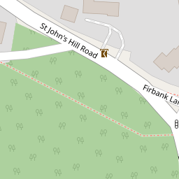
Images
Nearby Streets
| Name | Average Price | Average Sqft | Distance |
|---|---|---|---|
| Parley Drive | £ 0 | 0 | 0.00 KM |
| Eastmead Connector | £ 0 | 0 | 0.00 KM |
| Hurst Close | £ 1,100,000 | 0 | 0.00 KM |
| St John's Road | £ 535,000 | 0 | 0.00 KM |
| Saint John's Lye | £ 0 | 0 | 0.00 KM |
Nearby Transport
| Name | NLC | TLC | Distance |
|---|---|---|---|
| Worplesdon | 5686 | WPL | 2.43 KM |
| Woking | 5685 | WOK | 3.08 KM |
| Brookwood | 5687 | BKO | 5.80 KM |
| London Road (Guildford) | 5632 | LRD | 8.08 KM |
| Guildford | 5631 | GLD | 8.23 KM |
Nearby Listings
| Address | Price | Type | Score | Distance |
|---|---|---|---|---|
| Firbank Lane, Woking, Surrey, GU21 | £ 1,250,000 | BUY | 8 / 10 | 0.16 KM |
| St. Johns Rise, Woking, Surrey, GU21 | £ 830,000 | BUY | Unknown | 0.20 KM |
| Holly Close, Woking, GU21 | £ 650,000 | BUY | 6 / 10 | 0.20 KM |
| St. Johns Rise, St Johns, Woking, GU21 | £ 850,000 | BUY | Unknown | 0.21 KM |
| ST JOHNS | £ 1,750,000 | BUY | 7 / 10 | 0.26 KM |
Nearby Properties
| Address | Price | Distance |
|---|---|---|
| 6 Firbank Drive | £ 647,000 | 0.00 KM |
| 1 Firbank Drive | £ 765,000 | 0.00 KM |
| 2 Firbank Drive | £ 450,000 | 0.00 KM |
| Jackmans End | £ 1,425,000 | 0.11 KM |
| Rusper Oaks | £ 650,000 | 0.11 KM |